|
The coordinates of the two towns:
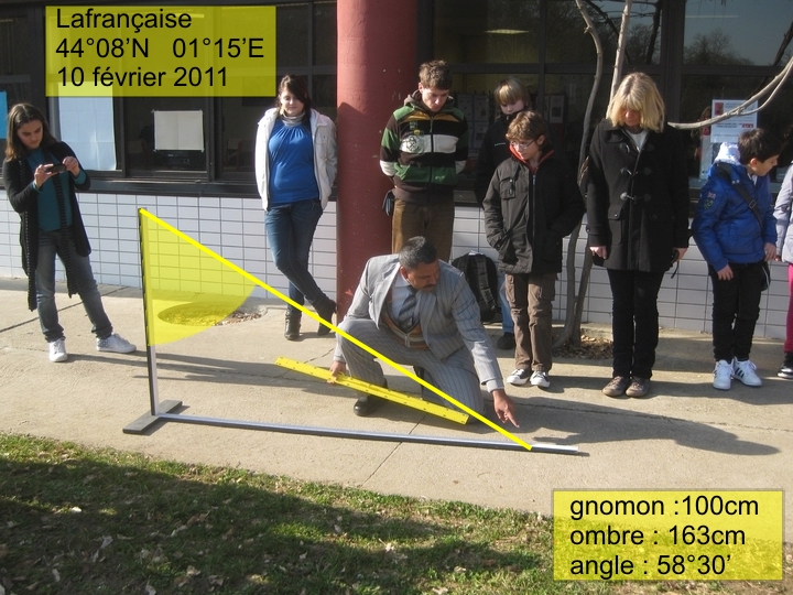
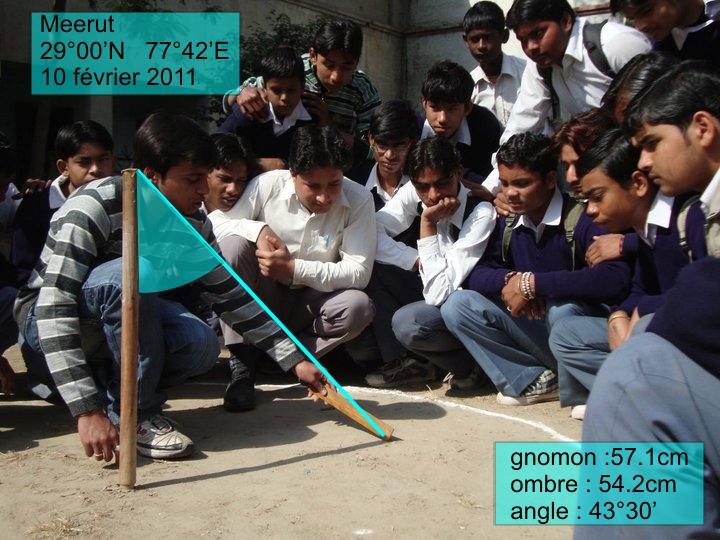
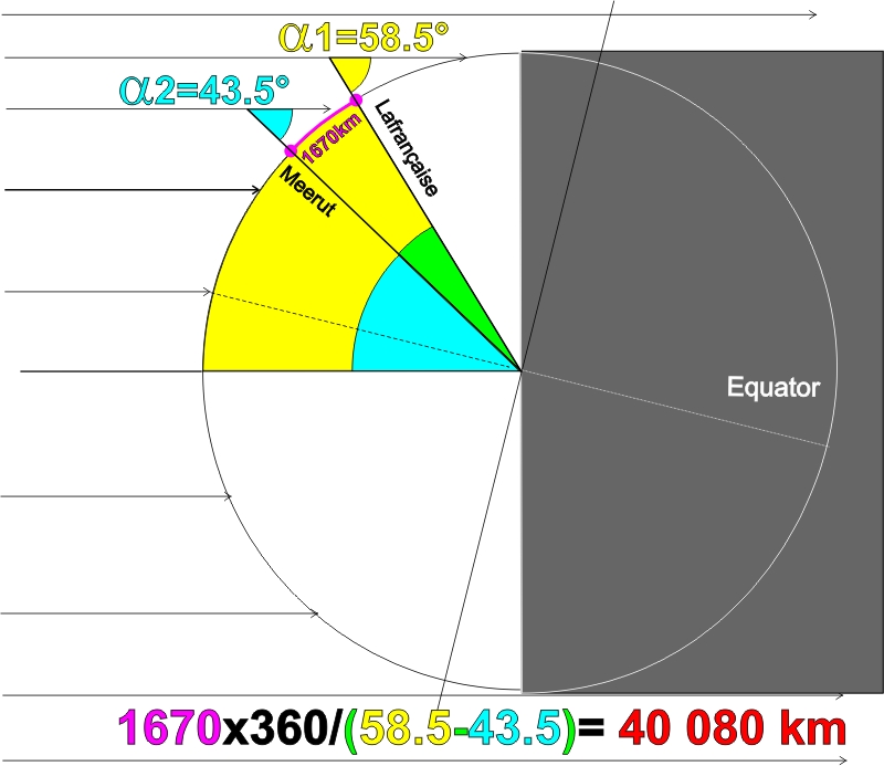
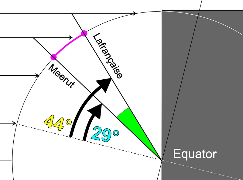
Lafrançaise: latitude 44°08’N, longitude 1°15’E Meerut, latitude 29°00’N, longitude 77°42’E. Thursday 10 February 2011. With these measurements the children are able to calculate the angle of the Sun’s rays (at midday local solar time), accurate to half a degree, using a very simple geographical figure (fig. 5): for Lafrançaise they find alpha 1 = 58.5° and for Meerut alpha 2 = 43.5°. |
|
|
|
But how is it possible, using these two angles to calculate the famous alpha angle. You need only subtract alpha angle 2 from alpha angle 1, which gives 15°.
|
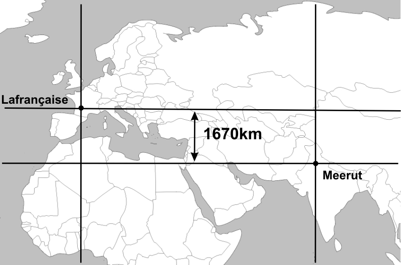
Since the two partnered schools are not positioned on the same meridian, the shortest distance must then be determined between the parallel of Lafrançaise and the parallel of Meerut. This is very easy: on a map, a careful tracing is made of the two parallels and, using the map scale, the distance between them is calculated. Here the value found is in the order of 1670 km.
|
|
We now have in hand the two elements needed to calculate the Earth’s meridian using "Eratosthenes’ method": the alpha angle of 15° and the distance of 1670 km between the two parallels. The proportion of a whole circle relative to the result of 15° being 24 times (360° divided by 15°), the meridian is calculated by multiplying 1670 km by 15, which indeed gives 40 080 km….An efficient method, provided that the measurements are as precise as possible (especially if the latitudes are nearer to one another !).
Remark : It is interesting to note, as shown in figure 8, that the difference between the two latitudes gives the famous alpha angle immediately ! With our two partnered schools, this gives: 44°08’ - 29°00’ = 15°08’ . We note that the measurements made by the children are very accurate since our school friends deduced an angle of 15°, which was therefore very close. We stress the fact that the "direct method" for calculating the alpha angle using knowledge of the two latitudes must absolutely not be given to the children at the outset ! On the other hand, it could be useful to them, at a later stage, to detect any possible errors in their measurements… |
|
|
|
|
